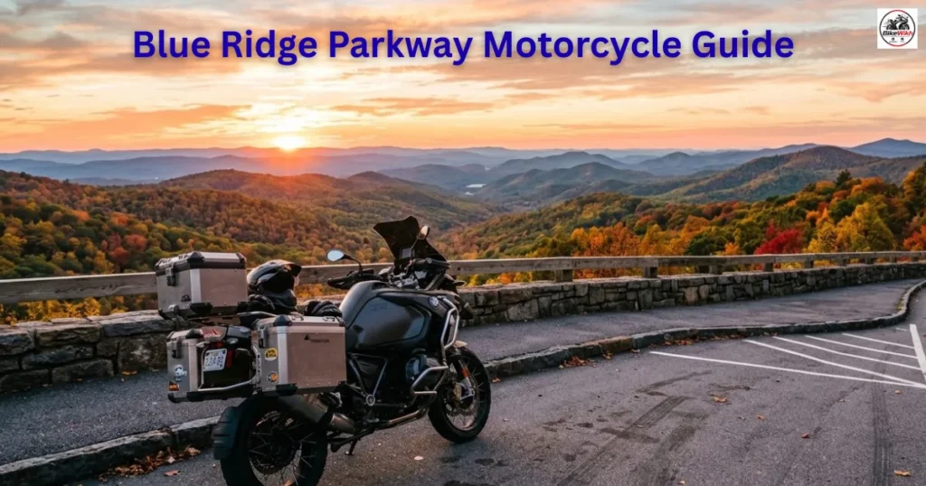
Blue Ridge Parkway Motorcycle Guide: There are ordinary stretches of highway, and then there are riding routes that completely alter your perspective on motorcycle touring. For riders across the United States, the Blue Ridge Parkway is undisputedly the latter. Stretching an incredible 469 miles through the Appalachian Mountains—connecting Virginia’s Shenandoah National Park to the Great Smoky Mountains National Park in North Carolina—it is a continuous ribbon of asphalt engineered specifically for scenic leisure.
Featuring absolute zero commercial truck traffic, no stoplights, and hundreds of sweeping mountain curves, it represents the ultimate pilgrimage for cruiser veterans, sport-tourers, and adventure riders alike. However, embarking on a multi-day mountain tour requires precise preparation.
In this comprehensive BikeWikh travel guide, we break down the ideal riding itinerary, essential gear checklists, speed enforcement traps, and seasonal weather patterns to help you plan the perfect Blue Ridge Parkway road trip.
Blue Ridge Parkway Motorcycle Guide: The Route Architecture: Speed Limits and Navigation
Before packing your saddlebags, you must understand the unique structural rules governing the Blue Ridge Parkway. The entire 469-mile length is maintained by the National Park Service, meaning it operates under strict federal jurisdiction.
- The Strict Speed Limit: The maximum speed limit across the entire parkway is 45 mph (and drops to 35 mph in high-elevation curves). While this might sound slow to sportbike riders, the route is designed for casual carving and heavy scenery viewing. Federal park rangers strictly enforce this limit; speeding fines are exceptionally high.
- Zero Commercial Mapping Glitches: Because there are no commercial gas stations, billboard signs, or hotels directly on the parkway pavement, navigation relies on Mileposts (MP). Stamped markers line the road starting at MP 0 in Virginia and ending at MP 469 in North Carolina.
The Perfect 3-Day Riding Itinerary
Trying to rush the entire parkway in a single day is impossible and dangerous. The ideal rhythm is dividing the journey into three distinct, highly scenic stages:
Day 1: The Virginia Ridge (Milepost 0 to Milepost 120)
- Starting Point: Waynesboro, VA (MP 0)
- End Point: Roanoke, VA (MP 120)
- Standout Milestone: Humpback Rocks (MP 6) and James River Visitor Center (MP 63). This section features rolling hills, historic farm layouts, and smooth, flowing curves that allow you to settle comfortably into your bike’s suspension rhythm.
Day 2: The Plateau Crossings (Milepost 120 to Milepost 290)
- Starting Point: Roanoke, VA (MP 120)
- End Point: Blowing Rock, NC (MP 290)
- Standout Milestone: Mabry Mill (MP 176)—the most photographed historic watermill on the entire route—and the transition across the Virginia-North Carolina state border. The geography opens up into massive high-altitude plateaus with wide-open vistas.
Day 3: The Technical Crests (Milepost 290 to Milepost 469)
- Starting Point: Blowing Rock, NC (MP 290)
- End Point: Cherokee, NC (MP 469)
- Standout Milestone: Linn Cove Viaduct (MP 304), an engineering masterpiece where the bridge hugs the contours of Grandfather Mountain, and Mount Mitchell (MP 355), the highest peak east of the Mississippi River. This final section is highly technical, featuring tight curves and rapid elevation changes.
Essential Travel Preparation & Packing Checklist
Because the parkway isolates you from commercial towns, your on-bike inventory must include specific safety gear:
- Layered Apparel / Rain Gear: Mountain weather changes rapidly. You can start a ride at a warm 75°F in the valleys and hit a shivering 50°F fog bank at a 5,000-foot peak within 30 minutes. Always pack a compact waterproof rain suit and a thermal base layer.
- Fuel Strategy Management: There are zero gas stations directly on the parkway. You must dive off the mountain exits into local border towns to refuel. As a strict rule, whenever your fuel tank drops to half capacity, exit at the next intersection to top up.
- Hydration & Hydradry Packs: High-altitude mountain air dries your body rapidly. Wear a hydration backpack to sip water continuously while riding to maintain razor-sharp focus through technical switchbacks.
Blue Ridge Parkway Motorcycle Guide:
| Travel Season | Temperature Range | Road Conditions / Traffic | BikeWikh Recommendation |
|---|---|---|---|
| Spring (May) | 55°F – 70°F | Fresh mountain blooms, minimal crowds, occasional rain | (4/5) |
| Summer (July) | 65°F – 80°F | Cool refuge from valley heat, heavy family RV traffic | (4/5) |
| Autumn (October) | 40°F – 60°F | Stunning, vibrant fall foliage colors; extreme tourist congestion | (5/5) |
The Verdict: The Ultimate American Road Trip
Motorcycle touring along the Blue Ridge Parkway is a bucket-list experience that every rider should complete at least once. By respecting the strict federal speed limits, planning your fuel exits carefully, and wearing adaptive, layered gear, you can safely navigate this legendary Appalachian corridor. Check your tire pressures, balance your saddlebag weight distribution, and embrace the slow, meditative rhythm of the open road!